Cottonwood Creek Trailhead
Wyoming
Added
June 30th, 2026
Adventurer unlock
Directions, weather, and nearby services help you decide if this stop works tonight.
- Directions in Google, Apple, and Waze
- Weather, cell coverage, and elevation
- Nearby services and recent check-ins

About this place
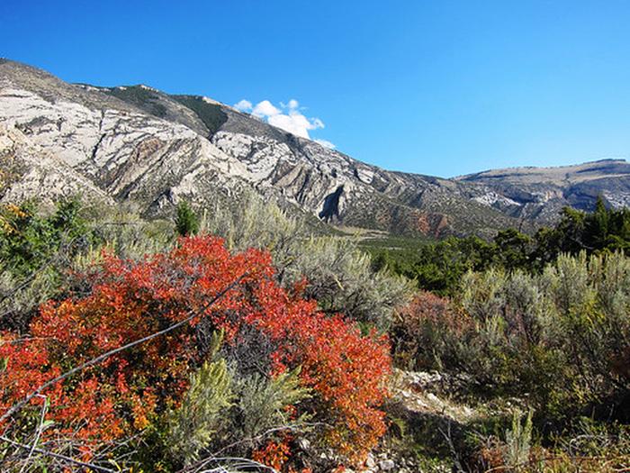
Located near the Cottonwood Canyon Campground and Day-Use site, this highly scenic trail is suitable for hiking and horseback riding (advanced riders). Cottonwood Canyon has steep, vertical cliffs. The elevation at the mouth of the canyon is 4,800 feet with the top of the canyon wall at 7,200 feet. At the upper end of the trail, the elevation at the creek is 7,000 feet and the top of the canyon wall is 7,900 feet. The trail is about 4 1/2 miles long and winds through BLM-managed public land, Bighorn National Forest land and State of Wyoming land. The trail accesses the Bighorn National Forest where one can continue hiking or horseback riding on primitive roads and trails. Vegetation in Cottonwood Canyon include narrowleaf cottonwood, willow, waterbirch, red osier dogwood, big sagebrush, juniper, mountain mahogany, Rocky Mountain maple, Indian ricegrass, ninebark, limber pine, Douglas-fir, aspen, and bluebunch wheatgrass. Things to note: Bring drinking water as Cottonwood Creek disappears underground at times. If using water from the creek, filter it or otherwise treat before drinking.
Details
GPS 44.86783, -108.07102
Phone
None
Website
None
Nearby places
- Cottonwood Creek Campground Campground (Free Public) 0.1 mi
- Five Springs Falls Campground Campground (Free Public) 6.5 mi
- Porcupine Falls Trailhead Trailhead 7.8 mi
- Intermission Fire Observation Site Campground (Free Public) 7.9 mi
- Bucking Mule Falls Trailhead Trailhead 8.2 mi
- Crystal Creek Snowplay Area Trailhead 9.2 mi
- Duncom Mountain Burn Observation Site Campground (Free Public) 9.7 mi
- Porcupine Campground (Wy) Campground (Paid Public) 11 mi
Check in
Share a visit note and optional photos for other travelers.
Sign in to check in, save this place, or add your own.
Recent check-ins
No check-ins yet for this place.